This topic is in the 2016 archive. You can read it and like its posts here. It is read only.
Archive 2016Official drone photography IMAGE thread. (Not primarily for discussion, ...
p.40 #1Official drone photography IMAGE thread. (Not primarily for discussion, see post #1)
All four images below are from the lower Grand Coulee area of eastern Washington state. This is near the Lake Lenore caves, for those familiar with this area. The first two images (looking south) show the southern end of the Great Blade, with Lake Lenore. The Great Blade is the longest blade of flood-eroded basalt within the Channeled Scabland of eastern Washington state. The third image shows the Great Blade (looking north), with Alkali Lake. The fourth image shows great flood flow striations and potholes, just east of the Great Blade. If only Harlen Bretz had had the use of drones a hundred years ago...
https://photos.smugmug.com/Places/Aerial-Images/i-cVBxzQN/0/KQ4NTRkFqCpbBLLJRrpX2TJMXLgZwtLMz5nqgGdL8/X2/DJI_20251007101721_0517_D-X2.jpg
https://photos.smugmug.com/Places/Aerial-Images/i-WLSpDXR/0/LQhwSZbGXWCXSK4M3h8q4qkrd85DFDxZ8n4Fq8DCC/X2/DJI_20251007102708_0587_D-X2.jpg
https://photos.smugmug.com/Places/Aerial-Images/i-R2Wrmpd/0/NKWZHHQvSKNhDmJn2gHcGJ7tfrXfDcw28K2WdwpQs/X2/DJI_20251007101351_0477_D-X2.jpg
https://photos.smugmug.com/Places/Aerial-Images/i-2FqBkHM/0/LHVR4xMPp5kQF7Wd9Kb8krXvgwj4JNqRRtgG8Nxfr/X2/DJI_20251007101442_0488_D-X2.jpg
Oct 20, 2025 at 12:53 AM

p.40 #2Official drone photography IMAGE thread. (Not primarily for discussion, see post #1)
Pittsburgh - unfortunately mid-day, as I was just passing through. Mini 4 Pro:
https://www.jordansteele.com/2025/pittsburgh_aerial1.jpg
https://www.jordansteele.com/2025/pittsburgh_aerial_pano.jpg
https://www.jordansteele.com/2025/pittsburgh_aerial1.jpg
https://www.jordansteele.com/2025/pittsburgh_aerial_pano.jpg
Oct 21, 2025 at 01:09 PM
p.40 #3Official drone photography IMAGE thread. (Not primarily for discussion, see post #1)
Both images below were taken in upper Moses Coulee in eastern Washington state. The first image shows the terminal moraine, and outflow channels, of the Cordilleran ice sheet from our last ice age (about 14,000 years ago). That image is looking north up the Coulee. The second image is looking south down the Coulee. Second image was taken at day break, while the first image was taken several hours later. Both images were taken with the Mavic 4 Pro drone.
https://photos.smugmug.com/Places/Aerial-Images/i-bR99WgP/0/L6rHJhpKTBGkJgp7PbJ885RxJcdxhsZ3NfjL5rtjN/X2/DJI_20251008115137_0517_D-X2.jpg
https://photos.smugmug.com/Places/Aerial-Images/i-DDr2VWK/0/KwGPg3kNwfL78sHrSxwf9W2rKhQJBvLJhSJTjQD4b/X2/DJI_20251008081804_0129_D-Edit-X2.jpg
https://photos.smugmug.com/Places/Aerial-Images/i-bR99WgP/0/L6rHJhpKTBGkJgp7PbJ885RxJcdxhsZ3NfjL5rtjN/X2/DJI_20251008115137_0517_D-X2.jpg
https://photos.smugmug.com/Places/Aerial-Images/i-DDr2VWK/0/KwGPg3kNwfL78sHrSxwf9W2rKhQJBvLJhSJTjQD4b/X2/DJI_20251008081804_0129_D-Edit-X2.jpg
Oct 24, 2025 at 02:54 AM
p.40 #4Official drone photography IMAGE thread. (Not primarily for discussion, see post #1)
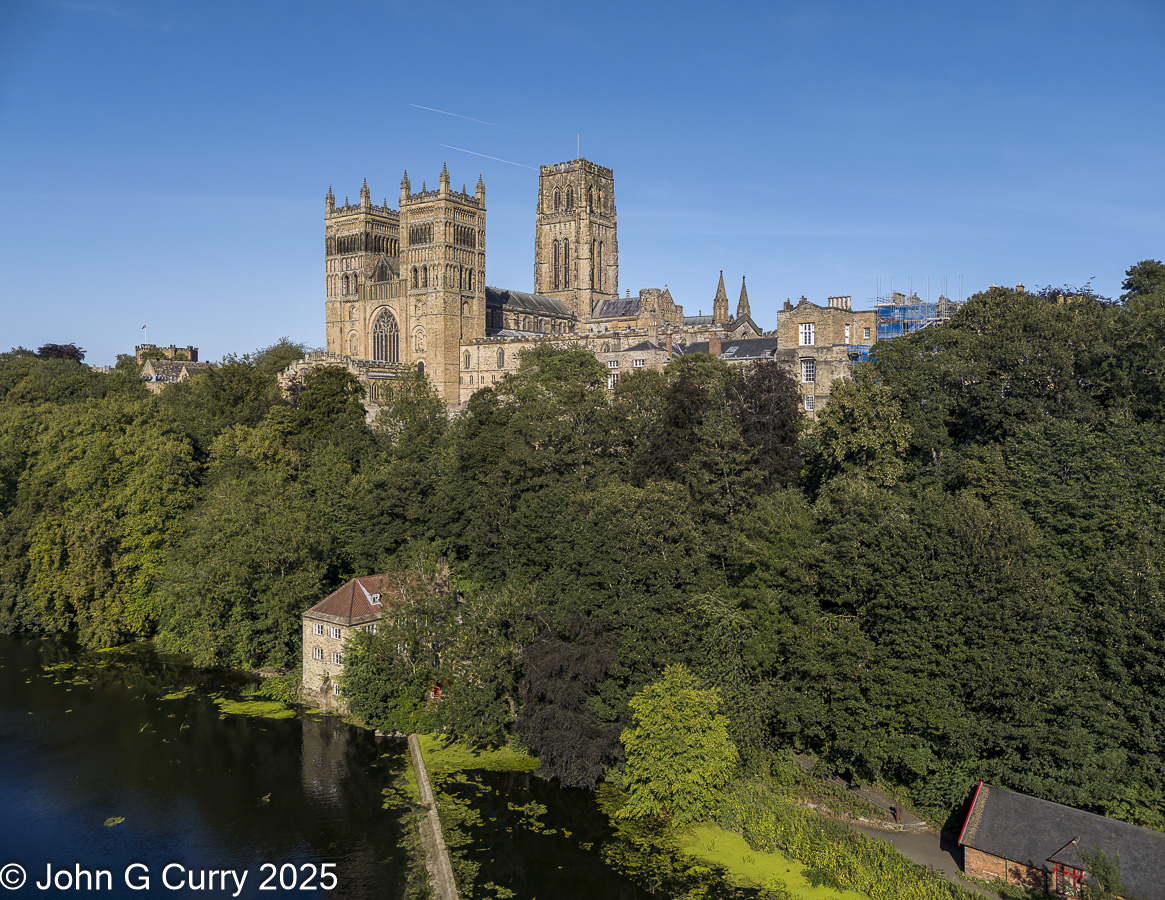
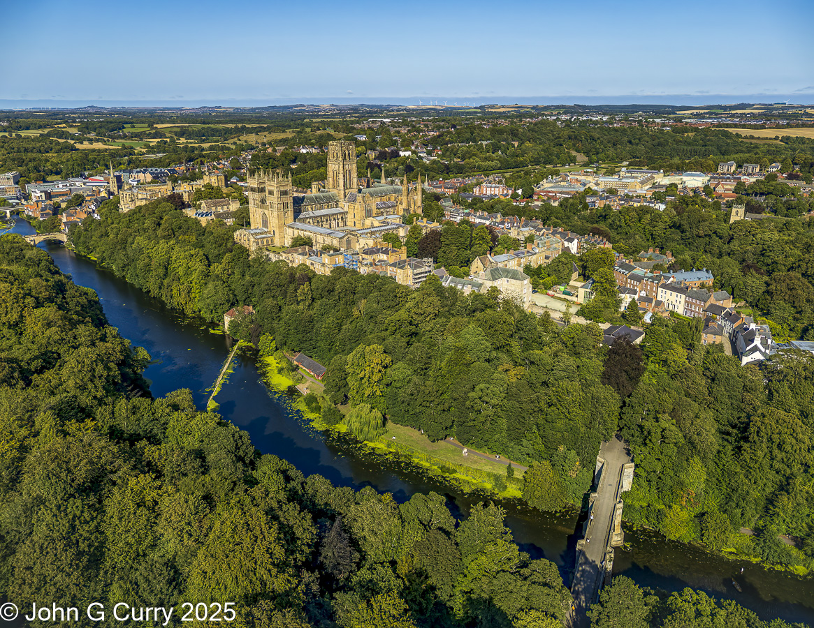
Taken with Mini 4 Pro.
Durham Cathedral and Fulling Mill
Durham Cathedral and Peninsula
 |
||
 |
||
|
Durham Cathedral and Fulling Mill
FC8482 24.0 mm f/1.7 lens 7mm f/1.7 1/640s 100 ISO -0.7 EV
|
||
 |
||
|
Durham Cathedral and Peninsula
FC8482 24.0 mm f/1.7 lens 7mm f/1.7 1/800s 120 ISO -0.7 EV
Oct 24, 2025 at 04:30 AM
p.40 #5Official drone photography IMAGE thread. (Not primarily for discussion, see post #1)
Hopefully pulling this thread out of the archive... Here are three images taken yesterday with the DJI Mavic 4 Pro. The first and third images were taken with the 168mm equivalent lens/camera, while the second image was taken with the 70mm equivalent lens/camera:
https://photos.smugmug.com/Places/Aerial-Images/i-DrHDWPP/0/Ld3g6LPDDGshzMTGNNncNtHdHkxQdfzCrqcJpdkF7/X2/DJI_20260119165807_0248_D-X2.jpg
https://photos.smugmug.com/Places/Aerial-Images/i-jqJWZtp/0/KJrRrf545kVw8ZbZ5HPdKRwhmTZfzfB2RKvs8J3kN/X2/DJI_20260119170723_0381_D-X2.jpg
https://photos.smugmug.com/Places/Aerial-Images/i-jfZ4R9k/0/MmXXm4Vpv46ZBCfNbhz4WJ84j5qMkCzWVcK2RHHzf/X2/DJI_20260119172944_0566_D-X2.jpg
Jan 20, 2026 at 05:35 PM